(Using data from 2020-09-13)
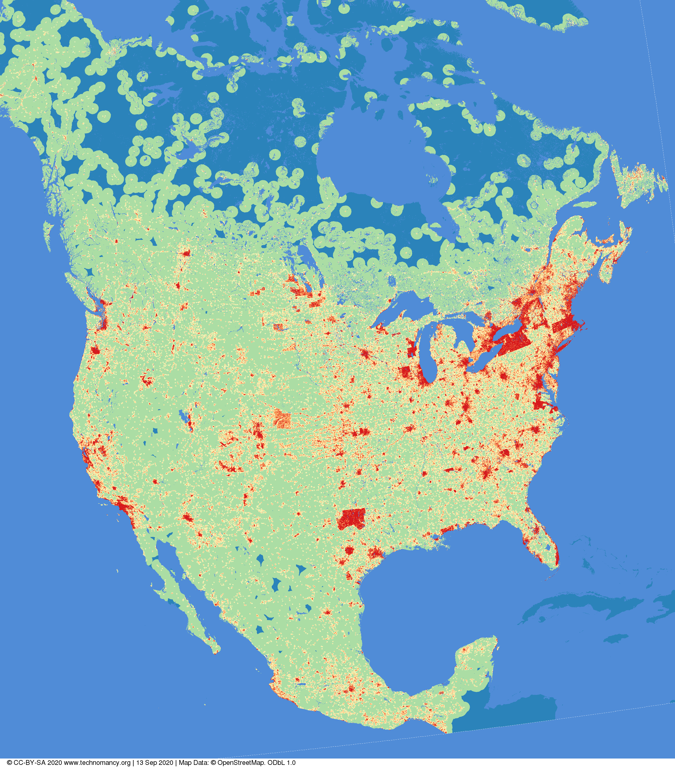
I created some software to generate maps from OpenStreetMap, then I thought “I wonder if you took OSM data, and coloured the image based on the distance to the nearest building?”
NB: In USA, there's been a lot of raw imports of buildings in some regions, which gives some weird "hot spots" & sharp lines which won't exist in real life.
(red=0→1km, orange=1→2km, yellow=2→5km,green=5→50km, blue=>50km. Image © CC-BY-SA 4.0 technomancy.org, Map Data © ODbL OpenStreetMap Contributors)